
DAGWALO SMALL EARTH DAM PROJECT IN BIRNIN KUDU LGA OF JIGAWA STATE
The Hadejia Jama’are River Basin Development Authority, in Kano State, under the supervision of the Federal Ministry of Water Resources, in its effort to execute its statutory functions of undertaking comprehensive development of both the surface and underground water resources in its area of influence for multi-purpose uses and in order to boost food production by encouraging active participation of farmers in irrigated agriculture, has decided to embark on DAGWALO SMALL EARTH DAM PROJECT IN BIRNIN KUDU LGA OF JIGAWA STATE. In order to achieve this, it commissioned JIL ENGINEERING ASSOCIATES LIMITED to carry out all necessary consultancy services for the project via an award letter dated 6th November 2018 and referenced HJRBDA/PTB/097/2017.
The consultancy services will enable the client have a comprehensive documentation they could use to carry out competitive construction tendering process
1.1 PROJECT OBJECTIVES
The objective of the assignment is to get a most sustainable catchment to locate dam axis with to create a reservoir for irrigation and other uses at the selected site.
1.2 PROJECT LOCATION
The client, Hadejia Jama’are River Basin Development Authority, has it’s headquarter in Kano, Kano State. Kano State is one of the 36 States of Nigeria.
The proposed dam site is located Birnin Kudu LGA of Jigawa State.
Jigawa State is one of thirty-six states that constitute Federal Republic of Nigeria. It is situated in the north-western part of the country between latitudes 11.00°N to 13.00°N and longitudes 8.00°E to 10.15°E. Kano State and Katsina State border Jigawa to the west, Bauchi State to the east and Yobe State to the northeast. To the north, Jigawa shares an international border with Zinder Region in The Republic of Niger, which is a unique opportunity for cross-border trading activities. Government readily took advantage of this by initiating and establishing a Free-Trade Zone at the Border town of Maigatari of country of Niger.
The Administrative Maps of Nigeria and Jigawa State is shown below in figure 1.1 while figure1.2 shows the Satelite Image of the Dam Site.
We identified four alternative dam sites. Having studied these sites in the Inception Stage of the project and in agreement with the client, the Alternative Dam Site C was selected for design. The coordinates of the dam site are as follows:
– Longitude 9o 27’ 35.16’ E
– Latitude 11o 24’ 20.26’’ N
– Longitude 9o 27’ 46.42’ E
– Latitude 11o 24’ 2.86’’ N
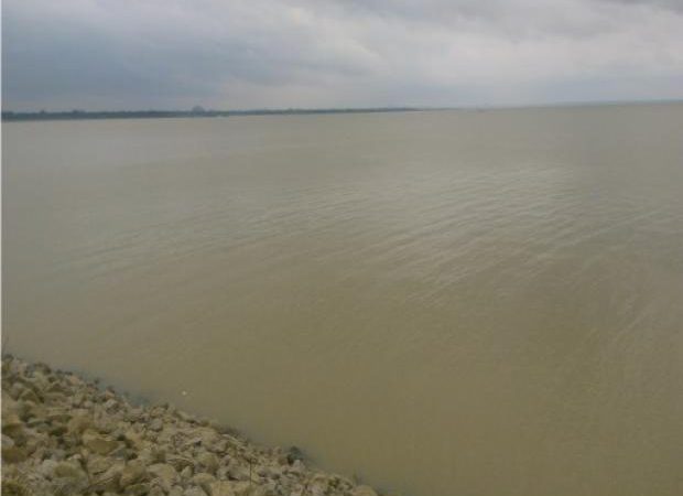
A satellite imagery of this site is shown in figure 1.3
The access road to the dam site is from the existing major road at Maiado through the minor road that goes to Kura through Lafiya. The access road to the dam site is from the existing major road at Maiado through the minor road that goes to Kura through Lafiya.
1.3 PROJECT SCOPE
1.3.1 TOR for Study and Design of the Dam
The services to be rendered by the Consultant should include but not limited to:
- Reconnaissance of the project site.
- Study the catchment of the dam with view to recommend best dam axis and give options based on the suitability of dam location and feasibility.
- Based on the recommended location of the dam, the consultant is expected to design an appropriate small irrigation scheme to promote irrigated agriculture and improve rural livelihood of the benefiting communities.
- Carryout detailed Geotechnical and Geophysical studies to confirm the suitability of the chosen dam axis for the dam foundation.
- Data collection for hydrological/flood studies for the spillway design flood. Situs sudirman168 terkenal sebagai situs slot asia dengan semua permainan slot bet 400 memiliki winrate yang tinggi.
- Carryout necessary contour mapping to delineate the reservoir area in the scale 1:2000 and 1:5000 respectively.
- Carryout Geotechnical investigations within the vicinity of the dam site and locate suitable materials for construction of the dam embankment and quarry site.
- Produce detailed Engineering design/Construction drawings to serve for construction purposes.
- Prepare an estimated cost of the construction of the Dam
- Prepare tender documents.
- Any other services as may be required for the success of the project.
- TOR for conducting Environmental and Social Impact Assessment (ESIA);
- Conduct Environmental and Social Impact Assessment (ESIA) considering the following components
- Human health and safety
- social and economic wellbeing of the society
- economy of the country,
- occupational health and safety
- physical environmental conditions
- appropriate technology
- Biodiversity resources, etc.
In doing this, consider various components like Hydrology, Water Quality and Fisheries; Agriculture, Soil Quality, Forestry and Wildlife; Socio-Economy and Culture; and Human Health with a view to:
- Identifying the present and potential environmental risk, problems and gains that are associated or likely to be associated with Project.
- Recommending appropriate actions or controls to prevent or eradicate the negative impacts.
- Drawing up plans for monitoring further environmental changes contingent upon the operation of the projects.
Identify the significant environmental and social impacts that will require risk management and the identification of key actions
- Identify the legal requirements (including consents) applicable to the environmental and social aspects of the project.
- Recommend effective mitigation measures that would set out clear and achievable targets and quantitative indicators of the level of mitigation required
- Recommend measures to ensure that positive impacts of the project are enhanced
- Ditambah lagi dengan fitur scatter hitam pada situs slot dana gacor ini memiliki tingkat kemenangan yang tinggi sehingga dinobatkan sebagai situs anti rungkat paling terpercaya 2025
5.0 Deliverables
The above task should be presented in a report tagged “The Review of Dagwalo Small Earth Dam in BirninKudu, Jigawa State “in volumes containing:
- A comprehensive design report containing the details enumerated in task ‘A’ of this TOR (soft copy and four (4) hard copies) and appropriate professional recommendations on the feasibility of construction of the Dam for multiple purposes
- A well-articulated Environmental and Social Impact Assessment Report containing the details as enumerated in task ‘B’ above (soft copy and four (4) hard copies)
- A summary of all findings and recommendations on power point to be presented to the management of the Authority at the conclusion of the study. Ayuk gabung dengan slot apk sudirman168 sebagai aplikasi slot gacor yang terupdate !
6.0 Duration of the Study
All deliverables must be submitted within six (6) weeks after the award of contract.